Palestinian app helps drivers avoid Israel checkpoints
A new locally-developed app helps Palestinian drivers in the occupied West Bank negotiate traffic at Israeli military checkpoints and uncover routes to towns mainstream providers often miss
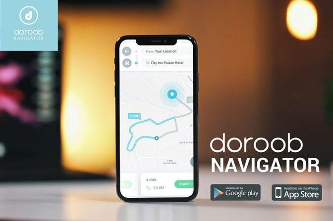
Launched in June and designed by Palestinians, Doroob Navigator crowd-sources road closures and traffic data from users. It aims to supplant apps like Google Maps and Waze, which rarely account for Israeli restrictions and struggle to navigate between Palestinian cities.
Israel illegally captured the West Bank in 1967. It has since place hundreds of checkpoints around the Palestinian area, some permanent others which appear overnight and which remain in situ for hours or days at a time. But the roadblocks limit Palestinian mobility and damage their economy, according to the World Bank.
In a July 2018 survey, the UN’s Office for the Coordination of Humanitarian Affairs (OCHAoPt) recorded that there are “705 permanent obstacles across the West Bank restricting or controlling Palestinian vehicular, and in some cases pedestrian, movement.”
These lead Palestinians to lose 60 million work hours a year, a study by the Applied Research Institute – Jerusalem (ARIJ) revealed earlier this year.
Mohammad Abdel Haleem, CEO of Doroob Technologies, said he knew Palestinians needed a new way to get around after a drive with Google Maps between the West Bank cities of Bethlehem and Ramallah left him lost in a remote valley.
“We had to design our maps completely from scratch. The wall, checkpoints, settlements … existing mapping software could never account for the complexity here,” Abdel Haleem, 39, said before using the app to drive through a checkpoint separating Ramallah from Beit El, a nearby illegal Israeli settlement.
The app, which has garnered 22,000 users in two months, is funded by Ideal, a Ramallah-based transportation and automation software company also led by Abdel Haleem. He says he hopes to monetise the app in the future in part via a delivery feature.
Other apps don’t understand.
The West Bank is scattered with illegal Israeli settlements and military bases, and the illegal Separation Wall which snakes through the territory.
Around three million Palestinians live in the territory along with some 450,000 settlers, who can generally drive in the area without major restriction using “bypass roads” which Palestinians are not allowed to travel on.
Doroob Navigator’s algorithm combines reports from users with manual inputs by engineering staff to help drivers avoid crippling checkpoint traffic and circumvent illegal settlements, which Palestinian vehicles cannot enter.
“Other apps might say the only way to drive between certain Palestinian cities is to cut through a settlement,” Abdel Haleem said. “We’re trying to change that.”
The app is also available in the Palestinian coastal enclave of Gaza, though most active users are in the West Bank, Abdeel Haleem says.
Palestinians in the past have relied on Facebook groups and word-of-mouth to anticipate West Bank traffic and closures. Waze is popular with Israelis, but many Palestinians say it directs them to routes they are restricted from driving.
“We need applications like this that help us move within Palestine,” said Nicolas Harami, 31, who uses the app while driving from his home in East Jerusalem to Ramallah and other West Bank cities.
“Other applications do not understand our situation.”
Source: Middle East Monitor
WRITE YOUR COMMENT